
Waikato Healthy Rivers Lake Freshwater Management Units - Waikato Regional Council
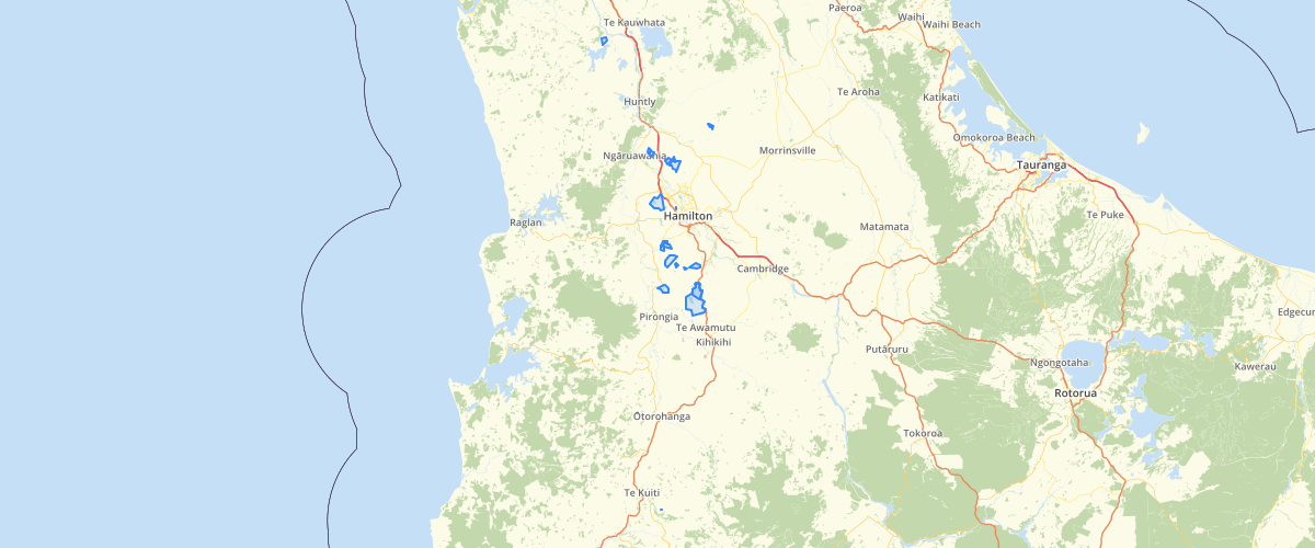
Request AccessFreshwater Management Units depicting lake catchments. Dune riverine, volcanic and some peat lake types were created from the NIWA REC Catchments. Not all lake FMU catchments are mutually exclusive (overlaps occur). For example; lake FMU catchment "A" can have an outflow to another larger lake FMU catchment "B" resulting in catchment "A" being contained by the larger catchment "B". An attribute - ORDER_RANK - is populated with values ranging from 1 to 3. 1’s are catchments that do not contain any other catchments within them. 2’s are catchments that contain one or more 1 catchments. 3’s are catchments that contain one or more 2 catchments. For cartographic purposes, ensure the display order follows ORDER_RANK; 1's drawn at the top of the display order, then 2's and 3's last. For analytical purposes, where two or more lake FMU catchments intersect the same polygon (ie farm property), use ORDER_RANK to determine which lake FMU catchment the polygon belongs to; 1's take primacy over 2's and 3's, while 2's take primacy over 3's. The dataset includes boundary information for the Waikato and Waipa catchments that fall within the Waikato Regional Council legal boundaries or are covered by the RCP maps. This project is co-managed under the JMAs of Ngāti Maniapoto, Raukawa, Ngāti Tūwharetoa, Te Arawa River Iwi and Waikato-Tainui as at 12 February 2012. See metadata for feature HEALTHY_RIV_FMU_LAKE in Healthy Rivers - Plan Change 1 - GIS Layer
Metadata
| Date | 3/9/2020 |
| License | CC BY 4.0 |
Sample Properties
- {} 5 keys▶
- "Peat"
- 30.9715
- 1
- 7
- "Hendersons Pond"