
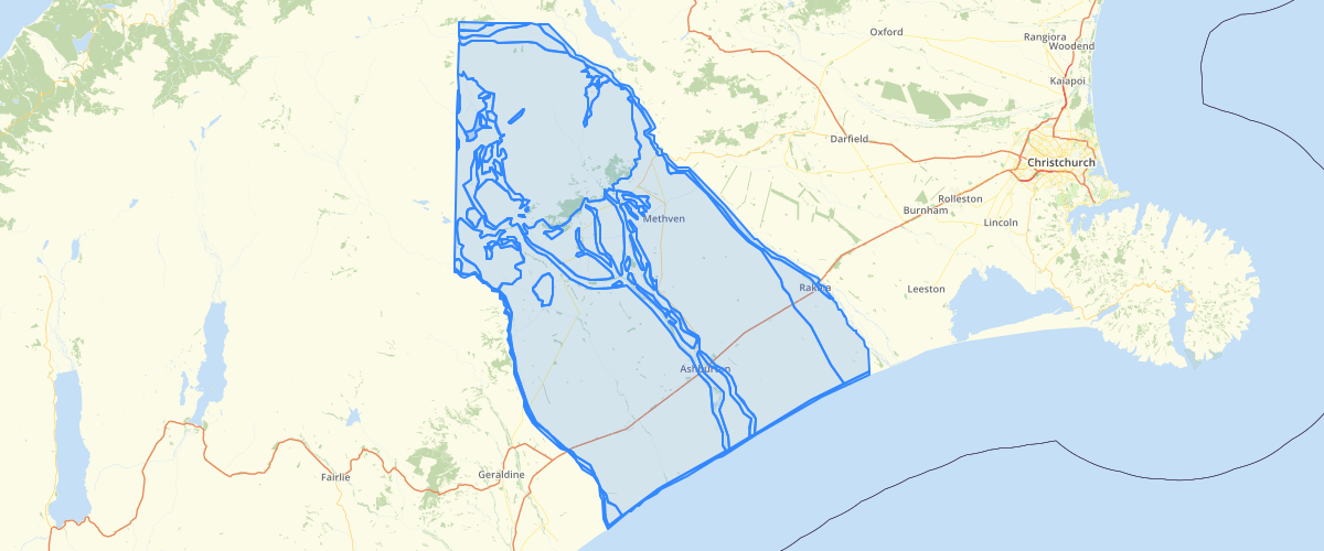
Canterbury - Ashburton liquefaction susceptibility 2002
Request AccessCanterbury - Ashburton liquefaction susceptibility 2002 - This dataset delineates zones of liquefaction susceptibility. The zones have been digitised from the liquefaction potential map (Figure 7.1) in Yetton & McCahon, 2002, Ashburton District Engineering Lifelines Project: Earthquake Hazard Assessment. Environment Canterbury report U02/55. The northwestern part of the district was not included in the mapping because it is very sparsely populated. This dataset will be redrawn in 2014 using the more accurate 1:250,000 QMAP geological map unit boundaries.
Metadata
| Date | 27/03/2017 |
| License | CC BY 3.0 |
Sample Properties
- {} 8 keys▶
- 5
- 1
- "River sediments <10,000 years old (active river beds & flood plains). There is a possibility of liquefaction of small, isolated areas during strong earthquake shaking."
- ""
- ""
- "Low liquefaction potential"
- 853654.143842477
- 572900413.1426541