
Canterbury - LPRP - Geographic Extent of the Recovery Plan
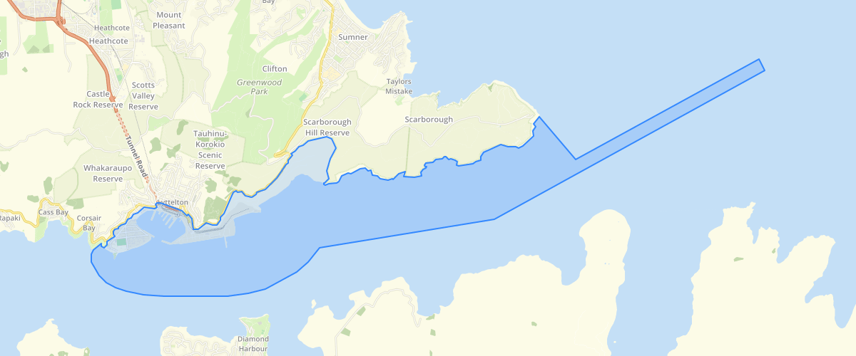
Request AccessCanterbury - LPRP - Geographic Extent of the Recovery Plan - Geographic Extent of the Recovery Plan as defined in the Lyttelton Port Recovery Plan. The Lyttelton Port Recovery Plan provides for the repair, rebuild and reconfiguration of Lyttelton Port and the redevelopment of Dampier Bay. It also establishes how transport issues and construction effects will be managed, and directs Environment Canterbury, Te Hapū o Ngāti Wheke, Te Rūnanga o Ngāi Tahu, Christchurch City Council and LPC to work together to develop a management plan to improve the health of Whakaraupō/Lyttelton Harbour and its catchment. The Lyttelton Port Recovery Plan directs amendments to the following district and regional planning documents to enable the Port's recovery: 1. Canterbury Regional Policy Statement 2013; 2. Regional Coastal Environment Plan for the Canterbury Region; 3. Proposed Christchurch Replacement District Plan; 4. Canterbury Land and Water Regional Plan; 5. Proposed Canterbury Air Regional Plan. These amendments are set out in the Appendices 1 to 5 of the Recovery Plan. For further information please visit http://www.ecan.govt.nz/our-responsibilities/regional-plans/lpr-plan/Pages/Default.aspx
Metadata
| Date | 27/03/2017 |
| License | CC BY 3.0 |
Sample Properties
- {} 8 keys▶
- 1
- 14264.0420665
- "Geographic Extent of the Recovery Plan"
- "Environment Canterbury"
- "2015-12-01T00:00:00.000Z"
- 1454.50878364
- 33478.04158060582
- 14545087.836426621