
Canterbury - Ashley Fault Avoidance Zone 2020
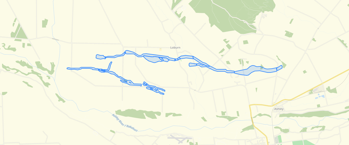
Request AccessCanterbury - Ashley Fault Avoidance Zone 2020 - Extent of the Ashley Fault Avoidance Zones. Areas of well-defined and distributed deformation have a 20 m buffer applied as per the Ministry for the Environment guidelines. Areas of uncertain and extended deformation were considered by the report authors to not have been mapped precisely enough to warrant assigning a 20 metre buffer. The joins between the well-defined and distributed deformation (with 20 m buffer) and the uncertain and extended deformation (without 20 m buffer) have been manually adjusted slightly to smooth out any sharp edges. The well-defined and distributed deformation areas (with 20 m buffer) have also been clipped out of adjacent uncertain or extended deformation areas.'Feature' is the type of ground deformation present.'FAZ_class' is the category of fault complexity, set out in Table 2 of the accompanying report, and following the MfE active fault guidelines.'NAME' is the fault or other landform unit that the deformation is associated with.'BUFF_DIST' is the width of the added buffer (20 m on well-defined or distributed deformation, 0 m on uncertain and extended deformation). The data were captured at a scale of 1:5,000 to 1:10,000.
Metadata
| Date | 04/05/2020 |
| License | CC BY 3.0 |
Sample Properties
- {} 7 keys▶
- "fault scarp"
- "well-defined"
- "Ashley Fault"
- 20
- 1
- 4066.3225579656687
- 124563.97739396246