
Canterbury - Hanmer Fault Trace 2004
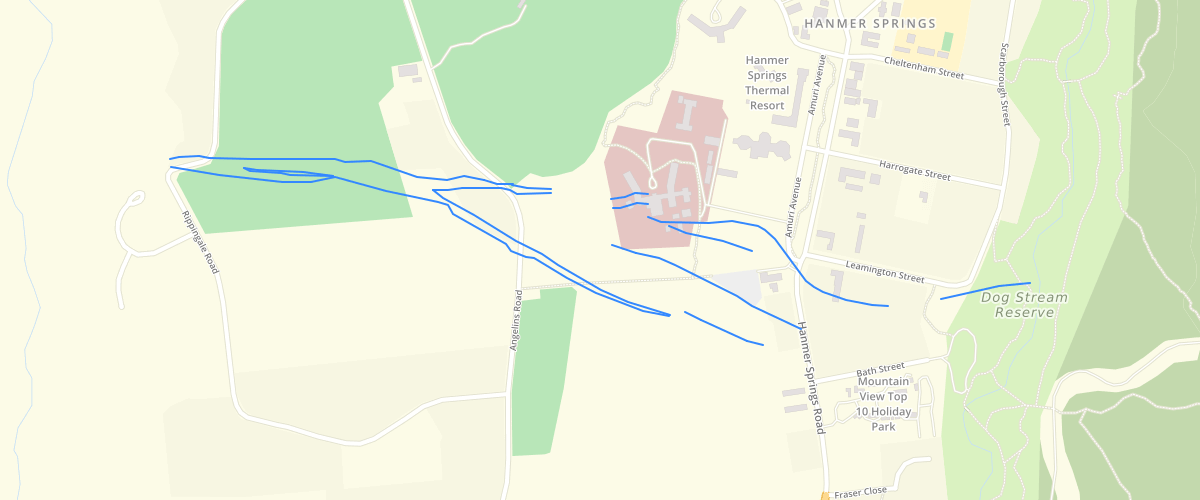
Request AccessCanterbury - Hanmer Fault Trace 2004 - The surveyed location of the Hanmer Fault through Hanmer Springs township. Collected by Mark Yetton, Geotech Consulting Ltd, and Helen Grant, Environment Canterburyusing differential GPSin 2004. Accurate to +/- 5 metres.Note that the original dataset also included two small parallel inferred fault traces to the north of the main trace in the Queen Mary Hospital site. During fault investigations in the area by GNS Science and Tonkin & Taylor in 2008 these were found to be man-made features. These fault traces have been removed from this dataset.
Metadata
| Date | 10/09/2018 |
| License | CC BY 3.0 |
Sample Properties
- {} 11 keys▶
- "top of scarp"
- "approximate"
- 1
- "MANCAP"
- 1
- "ECAN"
- "2004-01-01T00:00:00.000Z"
- "ECAN"
- "2004-01-01T00:00:00.000Z"
- 159.50323378
- 159.5032337833823