
Canterbury - River Public Access Sites
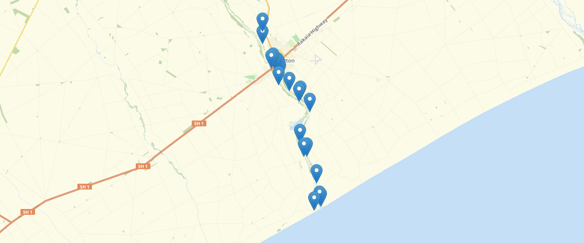
Request AccessCanterbury - River Public Access Sites - The data provides information on recreation and amenities at river access sites. The information describes the site and its amenities and suggests recreational uses. The public access sites are open to the public without obtaining prior landowner’s permission. Almost, every public access site has been visited by an Environment Canterbury staff member. During the site visit, information is collected that describes the site and photos are taken. The access site is usually located where it is appropriate to leave a vehicle, such as an informal parking area, or picnic area. Distances to the river bank are approximate and may vary depending on water and flow levels. The purpose of the data is to provide information on Canterbury’s public access sites, the data helps answer questions from the public relating to recreation and access. In addition, the data also helps meet some of the requirements set out by the Canterbury Water Management Strategy for Recreation and Amenity targets. The information is recorded in a consistent manner with consistent standards applied during its collection. The categories used to describe access are: Foot and vehicle access: pedestrian and vehicle access. Foot access: pedestrian access only Foot and vehicle access over private property: pedestrian and vehicle access, available over private property, permitted by the land occupier or owner Foot access over private property: pedestrian only access, available over private property, permitted by the land occupier or owner. The categories used to describe the quality of the road or track as described below: Good: well maintained, easily passable. Average: may require some care when driving a road car but still easily passable. Poor: difficult to drive along care and skill required, urgently in need of maintenance. 4WD: four-wheel drive recommended for track. For more information about the structure and content of this layer, please refer to the Data Dictionary. Caveats – conditions or limitations of the layer Every effort is made to identify public access points through site visits and checking the data by utilising maps, plans, and the digital cadastral database (DCDB). Every effort is made to survey all access points along riparian margins unless access is in a remote, hard to reach area, or is unlikely to be frequently visited by the public. The information is only accurate to the time of the survey, refer to ‘Date surveyed’ attribute for each access point
Metadata
| Date | 27/10/2020 |
| License | CC BY 4.0 |
Sample Properties
- {} 49 keys▶
- 230
- "ASH049"
- "2011-10-10T00:00:00.000Z"
- "Hakatere settlement B."
- "Left"
- "Seal."
- "Good."
- "Foot and vehicle access."
- 20
- "Foot access."
- "Gravel."
- "Poor."
- "Poor condition track."
- "Seat and informal parking."
- "Bird diversity. Didymo. No camping. No swimming."
- "Ashburton River lagoon, gravel shore."
- "Willow, exotic scrub and grass."
- "View point."
- "None."
- "Fishers."
- "Very poor access track, down a steep bank."
- ""
- "Ashburton River Mouth Hapua."
- "No"
- "No"
- "No"
- "No"
- "No"
- "No"
- "No"
- "No"
- "No"
- "No"
- "IM13E/3739"
- "Ashburton_River_Access_2011.shp"
- 1504437.3217
- 5121706.3914
- ""
- "MANCAP"
- 3
- "MirellaP"
- "2012-10-09T00:00:00.000Z"
- "MIRELLAP"
- "2020-10-20T00:00:00.000Z"
- "Not applicable."
- "Public"
- "NA"
- ""
- ""