
Southland - Liquefaction Risk 2006 - 2012
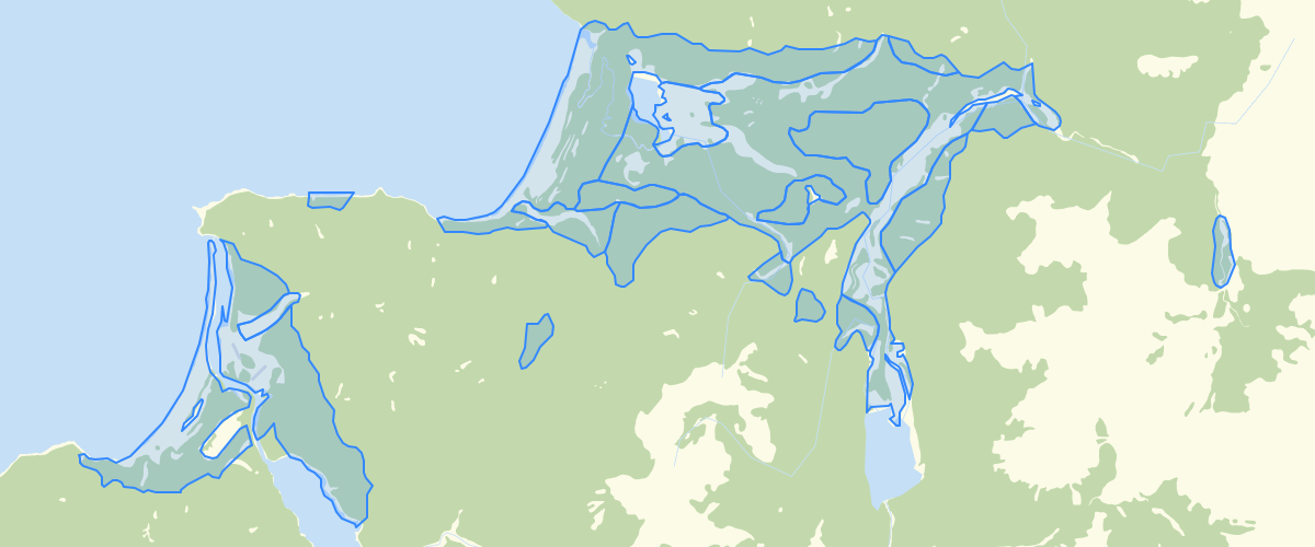
Request AccessSouthland - Liquefaction Risk 2006 - 2012 - The awareness of liquefaction has increased markedly since the Christchurch earthquakes. It is basically an earthquake related process of turning a solid soil into a liquid and weaker state. It is most likely to occur in saturated sands and silts. Related to liquefaction is a process called lateral spreading, whereby land moves towards lower areas whilst in a semi liquid state. The Southland areas considered most susceptible to liquefaction include low lying areas of hydraulic fill, peat mires, low lying parts of lake deltas and around the margins of the fjords. The last two magnitude 7+ earthquakes (22 August 2003 and 15 July 2009) resulted in isolated pockets of liquefaction.
Metadata
| Date | 27/08/2020 |
| License | This layer has been created for emergency planning purposes and is the best information that we currently have available. Environment Southland uses reasonable endeavours but does not warrant that this information is current, complete or accurate. Professional or specialist advice should be obtained before taking or refraining from taking any action on the basis of this information. To the extent permitted by law, Environment Southland will not be liable for any loss, liability or costs suffered or incurred as a result of any reliance placed on this information. |
Sample Properties
- {} 3 keys▶
- 6
- "Medium"
- "This classification is indicative only and is no substitute for detailed site investigations, including subsurface investigations, to determine ground conditions."