
Hawkes Bay Tsunami Near Source Inundation Extent - Hawkes Bay Regional Council
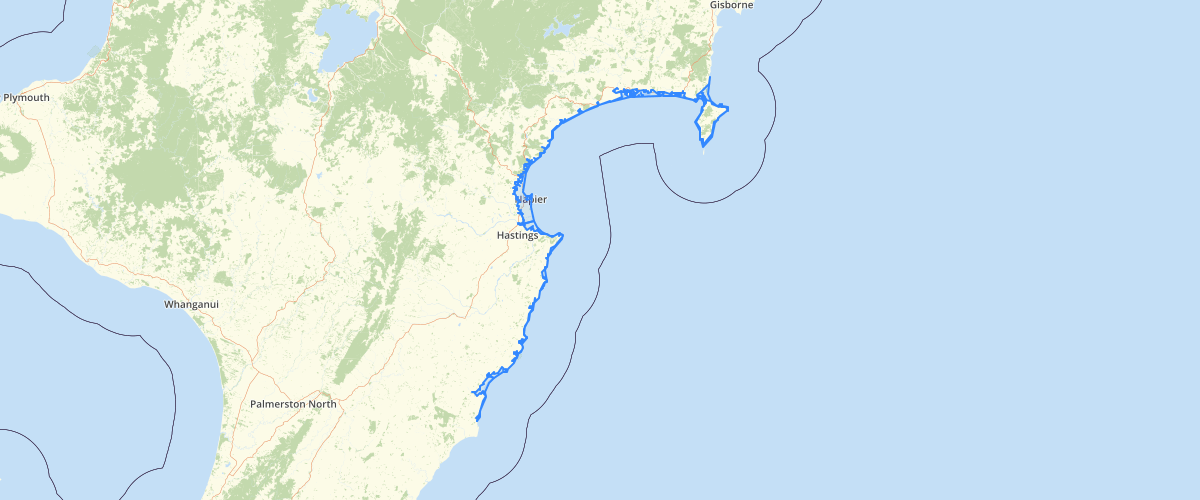
Request AccessTsunami (pronounced tsu - nam - ee) is a Japanese word meaning 'harbour wave'. It describes a series of fast travelling waves caused by large disturbances on the ocean floor, such as earthquakes, landslides or volcanic eruptions. In the deep ocean tsunami pass almost unnoticed, but as they approach land and therefore shallower coastal waters, they change dramatically - a wave 1-2 metres at sea grows into waves that can be over 30 metres in height.Hawke's Bay's position on the Pacific Ocean means there are risks of tsunami from both local, regional and distance sources, and the East Coast of NZ has the highest risk in the country. Our risks include destruction of homes, businesses and infrastructure in inundation zones, along with injuries and loss of life, with environmental devastation and the slow process of recovery.The Institute of Geological and Nuclear Sciences (GNS) & the Hawke's Bay Regional Council undertake modelling based on 2,500 year return period & combined the results to create tsunami extents.
Metadata
| Date | January 29, 2020 |
| License | No License Provided |
Sample Properties
- {} 16 keys▶
- 3
- "inundation extents derived from Craig Goodier Raster - Mahia_10mWave_MaxDepth"
- "2-Dimensional modelling"
- "2015-01-21T10:36:08.000Z"
- 12.39999962
- 2500
- 84
- "near"
- 12
- "Wairoa Coast"
- 67
- "Mahanga Beach"
- 12.4
- 24.8
- 18598381.03515625
- 56569.832124021144