
BoP Water Catchment Surface Drainage
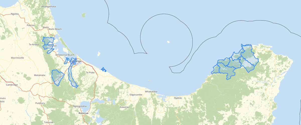
Request AccessCovers the whole of the Bay of Plenty Region. Provides those boundaries that have been defined for all major river catchments, most stream catchments and many of their tributaries. Each Polygon identified by hierarchy decending from primary catchment to subsequent tributaries/lakes. Catchments will be defined firstly by the named river or estuary that feeds to the coast. For instance the Motu and Whakatane rivers are obvious examples, but the Maraetotara Stream is also an example. For estuaries, Ohiwa estuary is an example where the Nukuhou River is part of the Ohiwa estuary catchment. In instances where the catchments of 'primary' rivers/streans have not been defined, the area that they occur within will be referred to as 'xxxxx coastal'. Examples on the current map are the Te Kaha and Waikawa Coastal catchments. Instances where some tributaries have been defined for a primary river, lake or estuary but others between these are still aggregated into one area, then this will be known as 'xxxxx area'. Examples of these are Rangitaiki/Kaingaroa area that lies between two defined tributaries, and the Kaituna/Lake Rotorua/Haumarana area. The catchments layer will exclude the lake polygons. The catchment for each lake will include the surface of the lake. If lake surface area is needed to be calculated then the lakes layer needs to be used in conjunction with this layer. Where a lake has no defined flowing surface-outlet that feeds to the coast, then that lake becomes the primary catchment. For example, Lakes Rotoma, Okaro and Rotoehu. As the catchments of tributaries to the 'primary' rivers/streams are defined they will named in a hierarchical fashion. For instance: if Brown River is a sub-catchment of Jones River, then that catchment will be labelled 'Jones/Brown'. Then if Bloggs River is a tributary of Brown River then it's catchment will be labelled 'Jones/Brown/Bloggs'. Where natural lakes occur as part of the catchment they will be considered in similar manner to a tributary (note that this means that individual lake catchments can be queried but that linkages between lakes are not shown as clearly. This mainly relates to the Lakes Rotorua - Rotoiti and Lakes Tarawera - Okareka linkages). For example, the Tarawera River starts at the outlet of Lake Tarawera and the Lake Okareka outlet feeds to Lake Tarawera. The Tarawera River below Lake Tarawera that is not defined into tributaries is called the Lower Tarawera. The Lake Tarawera catchment is called Lake Tarawera with the lake being included. The Lake Okareka catchment is called Lake Okareka. Where man-made lakes occur in rivers and the river continues above the lake, then that lake may become a catchment 'area' with its feeding tributaries to its shoreline, but any tributaries above the lake revert to the primary river. For instance, on the Rangitaiki River, Lake Aniwhenua could have its own tributaries if it is defined as an area, but the Horomanga and Whirinaki rivers remain secondary tributaries of the Rangitaiki, not Lake Aniwhenua. Naming conventions need to be firstly the official name as in 'Catchments of New Zealand, by Soil Conservation and Rivers Control Council, December 1956'. Otherwise an agreed 'local' name can be used. Where multiple local names are being used the alternatives should also be stored as part of the dataset for that catchment. Scale needs to be clearly defined for each catchment/sub-catchment. This will be based on the worst quality portion of the boundary capture. For example for a very large catchment there may be portions of the boundary captured at 1:10000, but if the majority has been captured at 1:50000, then 1:50000 is the appropriate scale to use the data for this catchment. Each database can choose the level/scale of sub-catchment 'definition' that is relevant to that database. User-defined catchments are useful in some catchments. However these will be identified on a separate layer and by a separate set of attributes to the sequential tributary attributes above. For instance, in the Rangitaiki the 'Kaingaroa area' has been split by some users into the 'Upper Rangitaiki' and 'Kaingaroa' catchments. (based on drainage to a certain point but excluding some major tributaries to the Rangitaiki River in these areas). Note that diversions such as for hydro-electric power stations have not been addressed in this layer. Subsequent refinement to the catchment boundaries is likely to continue to occur as the layer is used.
Metadata
| Provider | Bay of Plenty Regional Council Toi Moana |
Sample Properties
- {} 10 keys▶
- 343
- 41769.976413376135
- 52210350.87340666
- "{C6B7BB28-B6B0-42D4-BF97-0F76641996F6}"
- ""
- "Tuapiro"
- "Tauranga Harbour"
- "Tauranga Harbour"
- "Bay of Plenty"
- 343