
Wellington Regional Council Fault avoidance zones in Porirua NZ
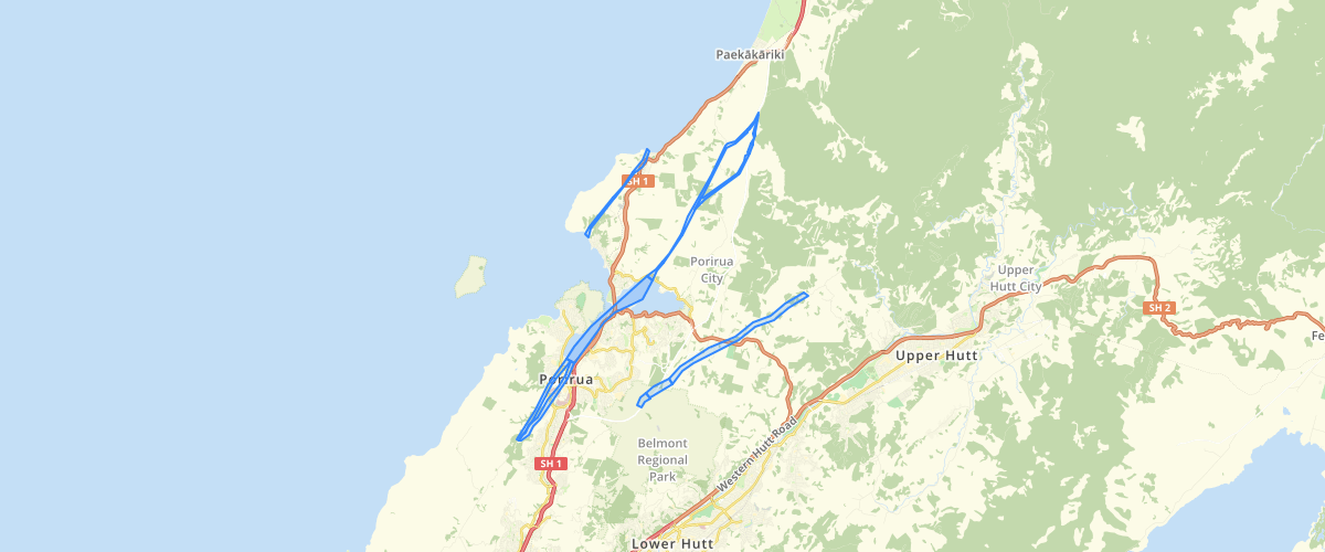
Request AccessWellington Regional Council - Fault avoidance zones in Porirua NZ, Porirua District is traversed by three active faults: the Ohariu, Pukerua, and Moonshine faults. In recognition of the surface rupture hazard posed by these faults, Greater Wellington Regional Council and Porirua City Council commissioned GNS Science for a reassessment and update of the fault traces.A review was undertaken of all existing data. Fault features were re-mapped using high resolution 2012 LiDAR and colour aerial photographs supplied by Greater Wellington Regional Council and Porirua City Council, supplemented by 1940’s aerial photographs.The faults were then assessed following the guidelines issued by the Ministry for the Environment (MfE) on planning for development of land on, or near, active faults. The aim of the MfE guidelines is to assist resource management planners tasked with developing land use policy and making decisions about development of land on, or near, active faults. The MfE guidelines promote a risk-based approach when dealing with development in areas subject to fault rupture hazard.Fault Avoidance Zones were defined around all known active faults in Porirua District.
Sample Properties
- {} 8 keys▶
- 1
- "Uncertain - poorly constrained"
- 2
- 2735502.3544921875
- 13006.042347116729
- 2735502.35449219
- 13006.04234712
- "Ohariu Fault"