
Canterbury - Ashley Fault Zone Landform Feature Lines 2014
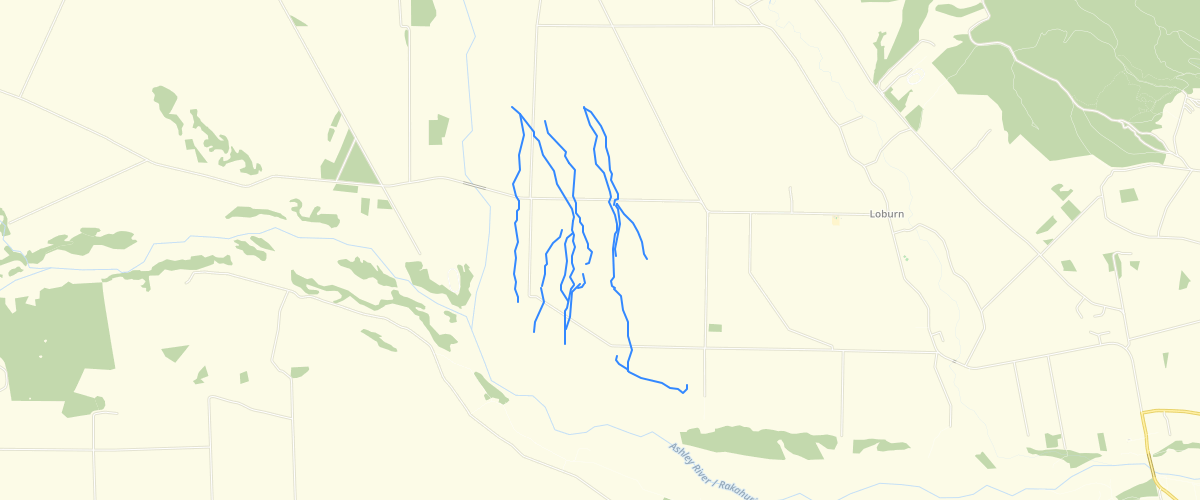
Request AccessCanterbury - Ashley Fault Zone Landform Feature Lines 2014 - There are two main data fields. 'ACCURACY' identifies the basis on which the line was mapped; 'schematic' (where the landform feature is sharply defined in a topographic sense, and thus the line denotes the general presence of a feature, not an exact location) and 'approx-lidar' (the feature is identifiable topographically in lidar data, but it is not mapped in fine detail). 'TYPE' identifies the nature of the mapped feature; only two types of feature are mapped, 'edge high ground' (indicating the crest of a slope between higher ground and lower ground), and 'terrace edge' (the approximatelocation of a step between a higher and a lower river terrace). The line is positioned at about the lower side of the step.Thisdatasethasbeen compiled for presentation at a scale of 1:35,000, but the data were captured at more detailed scales. The landform feature lines were mapped on-screen at a scale of approximately 1:10,000, and are considered to be accurate to about +/- 30 m. The accompanying report is Barrell, D. J. A.; Van Dissen, R. J. 2014. Assessment of active fault ground deformation hazards associated with the Ashley Fault Zone, Loburn, North Canterbury, GNS Science Consultancy Report 2013/173 / Environment Canterbury Report No. R14/77(Figure 2).
Metadata
| Date | 10/09/2018 |
| License | CC BY 3.0 |
Sample Properties
- {} 11 keys▶
- "approx - lidar"
- "terrace edge"
- 1
- "MANCAP"
- 2
- "GNS Science"
- "2014-01-01T00:00:00.000Z"
- "GNS Science"
- "2014-01-01T00:00:00.000Z"
- 1035.45077445
- 1035.450774448764