
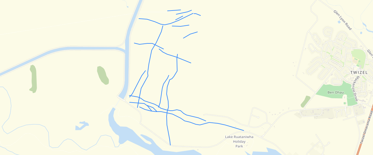
Canterbury - Ostler Fault Zone Active Fault Lines and Fold Axes 2010
Request AccessCanterbury - Ostler Fault Zone Active Fault Lines and Fold Axes 2010 - Location of fault traces and fold axes that form part of the Ostler Fault Zone. The southern part of the dataset ('Ruataniwha') was mapped with hand held and differential GPS in 2005, the northern part of the dataset ('Twizel') was mapped using aerial photos in 2010.Accompanying report is Barrell, D.J.A., 2010, Assessment of active fault and fold hazards in the Twizel area, Mackenzie District, South Canterbury. GNS Science Consultancy Report 2010/040. Environment Canterbury report R10/25 (Figures 2 and 3).
Metadata
| Date | 11/09/2018 |
| License | CC BY 3.0 |
Sample Properties
- {} 11 keys▶
- 1
- "surveyed"
- "anticline"
- "MANCAP"
- 2
- "GNS Science"
- "2010-01-01T00:00:00.000Z"
- "GNS Science"
- "2010-01-01T00:00:00.000Z"
- 683.53658179
- 683.5365817917962