
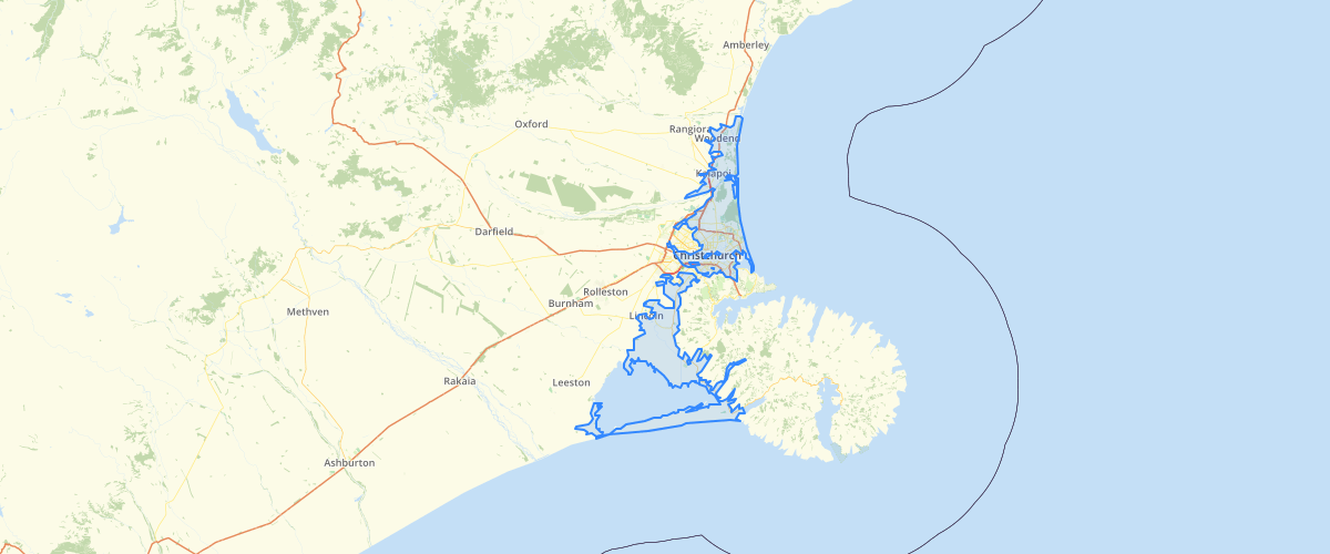
Canterbury - Coastal Confined Gravel Aquifer System
Request AccessCanterbury - Coastal Confined Gravel Aquifer System - The Coastal Confined Gravel Aquifer System is a relatively narrow band of confined gravel aquifers, situated near the coast between the Ashley and Rakaia rivers, bounded by the coastal marine area, Banks Peninsula, and on the western side by the line where sediments in the overlying confining layer are three metres thick. The aquifer system consists of at least five permeable gravel layers containing water (aquifer), separated by relatively impermeable layers of sediments (confining layers). Recognisable surface features have been used to approximate the natural boundary because the latter is not obvious at the ground surface
Metadata
| Date | 27/03/2017 |
| License | CC BY 3.0 |
Sample Properties
- {} 13 keys▶
- 1
- "Coastal Confined Gravel Aquifer System"
- 30775.8366039
- 11380878.4485459
- 1138.1
- "MANCAP"
- 4
- "GIS Admin"
- "2004-10-04T00:00:00.000Z"
- "GIS Admin"
- "2010-10-07T00:00:00.000Z"
- 11380878.448730469
- 30775.83660390289