
Southland - Tsunami Evacuation Zones
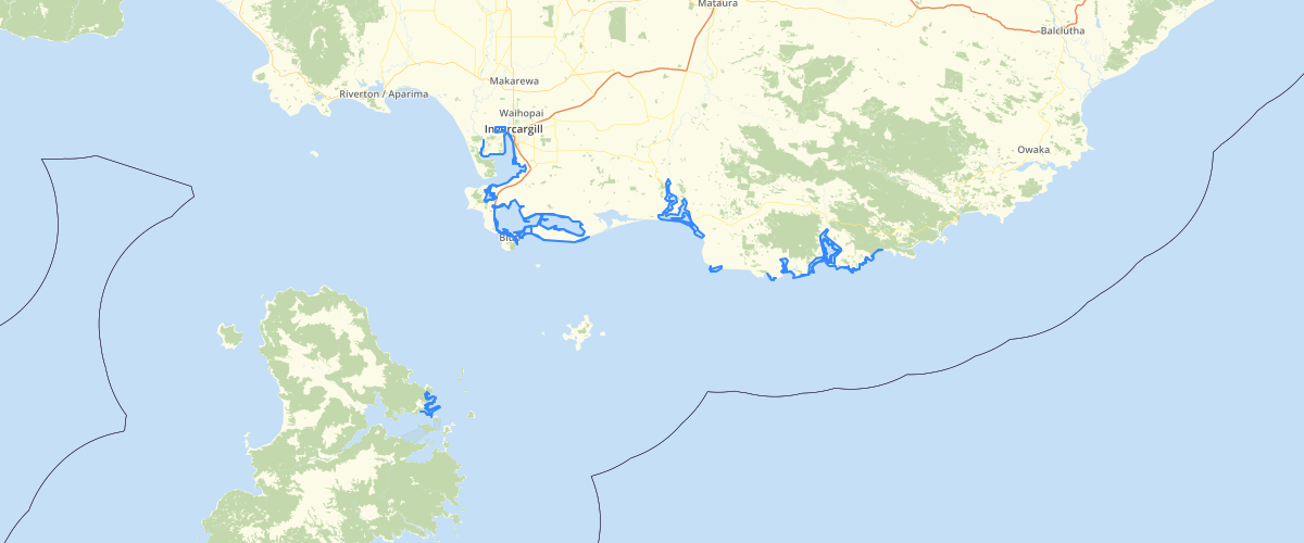
Request AccessSouthland - Tsunami Evacuation Zones -The dataset shows areas of populated places along the Southland coastline that should be evacuated when there is a tsunami up to 1 metre (red zone) or between 1 and 3 metres (orange zone). RED ZONE: Shore-exclusion zone. The highest risk and first place to evacuate from in any sort of tsunami warning (natural, unofficial or official). ORANGE ZONE: Evacuation zone for tsunami waves above one metre. You must also evacuate this area if you experience any natural warnings. Long OR Strong – GET GONE. TIWAI POINT: New Zealand’s Aluminium Smelter (NZAS) at Tiwai Point. This area is covered by NZAS’ emergency response plan. OUTSIDE ZONE: If you are not in an evacuation zone and you are in a low lying coastal area or near an inland water body you should consider moving to higher ground. Some areas may be cut off if your normal access goes through a tsunami evacuation zone, so be prepared to stay at home until the all clear is given. Do these maps show areas that will be flooded in a tsunami? No, they are evacuation zones. A tsunami evacuation zone is an area that you may need to evacuate from if you feel a long or strong earthquake, or if there is an official tsunami warning. There are different zones, based on the areas that could be affected in different sized tsunamis. How were the tsunami evacuation zones drawn? We used a three metre contour in the populated coastal areas. We are waiting on good ground height data and to use LiDAR modelling to create more definitive maps. These maps will be updated when that has been completed.
Metadata
| Date | 27/08/2020 |
| License | This layer has been created for emergency planning purposes only and not designed to be used in LIM reports. This is the best information that we currently have. Environment Southland uses reasonable endeavours but does not warrant that this information is current, complete or accurate. Professional or specialist advice should be obtained before taking or refraining from taking any action on the basis of this information. To the extent permitted by law, Environment Southland will not be liable for any loss, liability or costs suffered or incurred as a result of any reliance placed on this information. |
Sample Properties
- {} 5 keys▶
- 86
- "Fortrose"
- "1-3m Tsunami"
- "Orange"
- "ORANGE ZONE: Evacuation zone for tsunami waves above one metre. You must also evacuate this area if you experience any natural warnings. Long OR Strong – GET GONE."