
Canterbury - Ashley Fault Zone Ground Deformation 2014
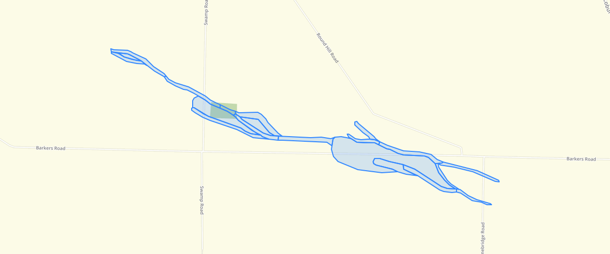
Request AccessCanterbury - Ashley Fault Zone Ground Deformation 2014 - There are five main data fields. 'AREA' gives the extent of each polygon in square metres. 'ACCURACY' identifies the basis on which the polygon was mapped, such as 'lidar', and whether interpretation was aided by examination in the 'field', or using 'satellite imagery'or Google Earth Street View (SV).'TYPE' defines the polygon according to the ground deformation classification set out in Table 2 of the accompanying report.'Fault_name' identifies the fault with which the ground deformation unit is associated.'Vert_offset' provides a general estimate of the amount of vertical deformation (if present, or if quantificable) associated with the map unit. This dataset was compiled for presentation at a scale of 1:35,000 in the report, but the data were captured at more detailed scales.The ground deformation classification map dataset is derived from the geomorphologic map unit dataset, and its accuracy is the same as for the geomorphologic map. The geomorphologic map units were drawn on-screen at a scale of approximately 1:10,000, except for tectonic landform map units, which were mapped at ~1:5,000 scale. Locations of the boundaries of the map unit boundariesare considered to be accurate to about +/- 30 m, apart from the tectonic landform unit boundaries, whichareconsidered to be accurate to +/- 10 m at best on the younger river terraces (Okuku Terrace 3/Makerikeri Terrace 2 and younger), but are no better than +/- 20 m on older terrace or hill landforms. Accompnaying report is Barrell, D. J. A.; Van Dissen, R. J. 2014. Assessment of active fault ground deformation hazards associated with the Ashley Fault Zone, Loburn, North Canterbury, GNS Science Consultancy Report 2013/173 / Environment Canterbury Report No. R14/77(Figure 5).
Metadata
| Date | 10/09/2018 |
| License | CC BY 3.0 |
Sample Properties
- {} 17 keys▶
- 10904.95773978
- "lidar"
- "fault"
- "Ashley Fault"
- "approx 2 m"
- 1
- "MANCAP"
- 2
- "GNS Science"
- "2014-01-01T00:00:00.000Z"
- "GNS Science"
- "2014-01-01T00:00:00.000Z"
- 869.25140918
- 10904.95769034
- 1.09049577
- 869.251409177205
- 10904.957690342195